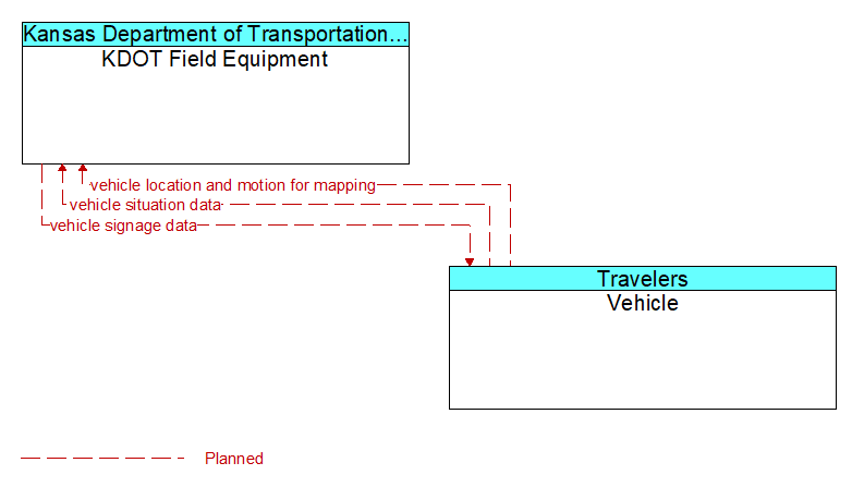
Interface: KDOT Field Equipment - Vehicle
Architecture Flow Definitions
vehicle location and motion for mapping (Planned)
Vehicles may provide location and motion data independently using wide-area wireless communications to application/service providers who use the provided data to update their maps and maintain real-time traffic and road conditions information sourced from their client-base.
vehicle signage data (Planned)
In-vehicle signing data that augments regulatory, warning, and informational road signs and signals. The information provided would include static sign information (e.g., stop, curve warning, guide signs, service signs, and directional signs) and dynamic information (e.g., current signal states, grade crossing information, local traffic and road conditions, detours, advisories, and warnings).
vehicle situation data (Planned)
This flow represents vehicle snapshots that may be provided by the vehicle to support traffic and environmental conditions monitoring. Snapshots are collected by the vehicle for specific events (e.g., when a sensor exceeds a threshold) or periodically and reported based on control parameters when communications is available. Traffic-related data includes snapshots of measured speed and heading and events including starts and stops, speed changes, and other vehicle control events. Environmental data may include measured air temperature, exterior light status, wiper status, sun sensor status, rain sensor status, traction control status, anti-lock brake status, and other collected vehicle system status and sensor information. The collected data is reported along with the location, heading, and time that the data was collected.